1
Expedition for cave biologists, speleologists, geologists, archaeologists and researchers
About the “Karst on the Roof of the World” project:
For speleologists, Tajikistan is a little-known country in Central Asia. Very little Speleological knowledge of the country is related to its remoteness and geographical closeness, as well as the lack of caves and people interested in cave exploration. Karst areas are located far from civilized centers very high in the mountains. Political problems did not allow exploring this region in the past. At present, Tajikistan is a rapidly developing secular country with favorable conditions and hospitality.
Currently, numerous groups of tourists visit Tajikistan every year. In Soviet times, many areas in Tajikistan were closed to the public. Most of the territory of Tajikistan is occupied by the great mountain range of Central Asia – Pamir, which means “Roof of the World.”
Pamir is a harsh alpine climate region, where locals and geologists know about several caves which entrances are located on inaccessible steep walls, which are composed of limestone of the devonian, carboniferous, cretaceous and jurassic geological periods. In such paleokarst conditions caves of different genesis were formed.
To date, we do not know much about Pamir and Tajikistan in general. For speleologists, the Pamir is an unexplored geographical area. On the territory of Tajikistan, there are several karst areas. It is an interesting and unique area of the Khoja-Mumin salt massif with large and beautiful caves formed in the salt strata. This is also the area where the cave Rangkulskaya (Syykyrdy-Unkur) in Eastern Pamir is located.
Also, an interesting area is located on the mountain plateau of one of the spurs of the Vakhsh Range, located north of the city of Nurek. Located on a plateau in the east-west direction, there are hundreds of karst sinkholes that haven’t previously been investigated. Very interesting is the karst area on the border with Kyrgyzstan. This is the Kuramin Range, where in ancient times silver and lead ores were mined in cave mines. Villagers say that in ancient times, and during the rule of the Bolsheviks, the local rulers hid treasures in deep caves. 
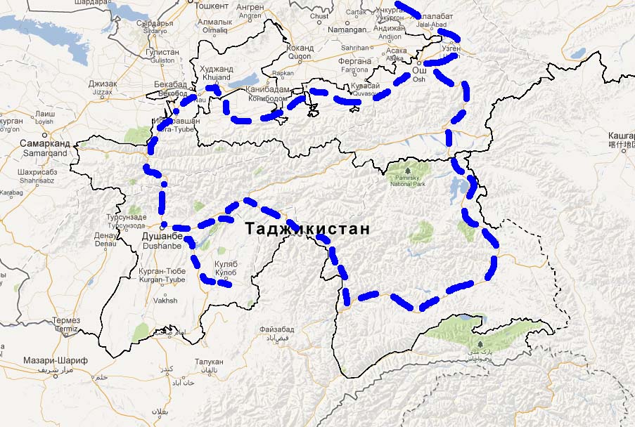
In 2020-2021, our Fund plans to conduct a speleological expedition to the karst areas of Tajikistan. The purpose of such a trip is to study potential karst areas. We want to know which area is more promising for finding new caves.
We plan to conduct this expedition in the second half of September 2020 with the aim of exploring all karst areas. We plan to start from the northern part of Tajikistan to explore the karst areas of the Kuramin ridge.
Further, our route to the south will allow us seeing and exploring areas of Eastern Pamir and the Tajik Depression. We plan to explore the salt crust of Khoja Mumin and Khoja States in the vicinity of Dushanbe, as well as to the south. These are giant salt mountains with salt caves where fantastic cave formations have developed.
Further, the expedition will continue to the northeast, where we are going to continue our speleological exploration in the karst regions to the northeast of the city of Nurek (South Tajikistan). Here in the northwestern spur of the Vakhsh ridge on a large kast plateau, numerous sinkholes were formed, these formed in the layers of gypsum and limestone rocks.
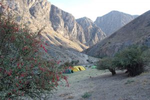
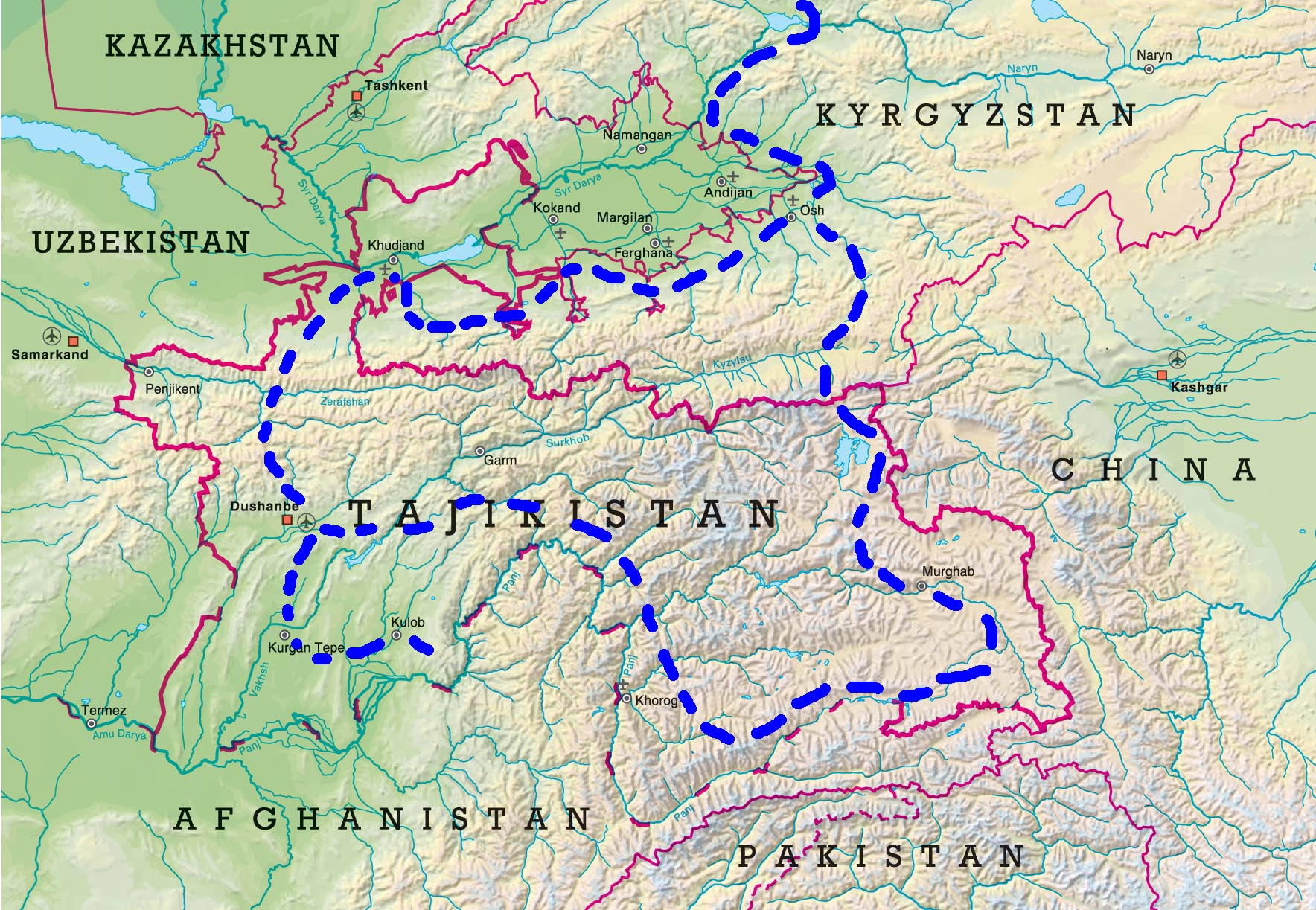
Our route continues through the Pamir towards Kyrgyzstan. Along the way, we plan to explore other karst areas of the Western Pamir and Southern Tajikistan. The duration of the expedition is 18 days. The optimal number of participants is 8-15 people. In Tajikistan, our local colleagues will provide us with good support and hospitality.
If someone wants to take part in the expedition, he/she can notify us no later than April 1, 2019. To visit certain border areas of Tajikistan, you must have a special permit. To this expedition, we invite speleobiologists to study the biodiversity in the caves, surrounding karst areas and sources.
Description of promising areas of research.
Those who are interested can also take part in the exploration of individual areas specified in the complex expedition route.
At the moment we have indicated the most favorable season of the year according to the climatic conditions in a particular geographical area. The program of the Karst expedition and the caves of Tajikistan. The described program is flexible. We can change the length of our staying in a particular area. The expedition is scheduled for September 2020. This is the most favorable time for the expedition to Tajikistan. After Tajikistan we return to Kyrgyzstan for the next stage of the expedition.
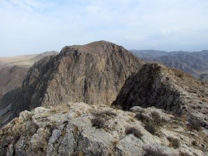
The Kuramin Range in the Western Tian Shan. It is located on the border of Tajikistan and Uzbekistan. The plans of the expedition are to explore the southwestern part of the ridge located on the territory of Tajikistan. The height of the mountain range is over 3,000 m.
The most interesting for speleologists are the ancient underground mines, as well as the surrounding limestone mountain massifs. Ancient miners of the IV, IX-X centuries left behind vast underground labyrinths, where they mined silver and lead. This place in northern Tajikistan is called Karamazar - the Black Grave.
Many slaves and prisoners, who were brought to the hard work of mining the precious metal at the time, remained under the ground forever, hence the name of the ancient mine.
Now, no one knows about the true size of the ancient underground workings. For 1500 years, the size of the underground labyrinths could be of more than 10 km. One of the largest mines here is Kanimansur – Mansour’s mine. It was first described by Russian travelers. The size of the underground cave mine is impressive.
However, besides the ancient mines, we are interested in new caves. If there are numerous underground galleries in the limestone massif, that have been expanded by ancient miners in the process of mining, therefore, in the Kurama limestone ridge should have been formed caves that subsequently resulted in the formation of minerals. Karamazar, as well as some of the caves in Kyrgyzstan are confined to the South Fergana hydrothermal-mineral belt, in the zone of which formed underground karst cavities filled with ore or different minerals depending on the fluid temperature, filling the cavern.
Previously, speleologists did not explore the Kuramin Range. There were separate small expeditions to visit the ancient mines. The tasks of the future expedition include: the study of biodiversity, the search for new caves on the southern slopes of the Kurama Range, an evaluation of the karst area
Khoja-Mumin
Khoja Mumin Salt Mountain is located in the south of Tajikistan, 25 kilometers south-west of Kulyab. Khoja Mumin is shaped like a giant dome that rises 900 meters above the surrounding plain (its altitude is 1332 m). It is visible from tens of kilometers. Because of the white salt that makes up the mountain, it seems that the mountain is covered with fresh snow. The length across the mountain reaches 8.5 km. Together with the adjacent ridge Hodge Surtees, it belongs to the largest diapir in the world. Similar salt mountains are found in southern Iran, this is Kuhi Namak. The remaining known salt massifs are located in Palestine and on the Arabian Peninsula.
The slopes at the foot of the mountain are steep and the height of the exposed salt walls reaches 500 m. The formation of the salt mass of the massif occurred in the second half of the Mesozoic era in the Late Jurassic era.
On the slopes of the massif, there are many karst sinkholes. These karst dips reach 200 m in diameter. Many dips have the form of vertical wells or mines with dark openings. The abundance of salt caves makes them difficult to count. Of the famous caves of the giants, the Great Circus Cave is 1200 meters long. On the southeastern side of the massif there is a large stalactite cave, Tiger Spring. Baths, holes, salt, gas and other formations are formed at the entrance of the cave.
Inside the cave, there are narrow corridors and spacious rooms, up to tens of meters high. The atmosphere of the cave is saturated with salt. As a result, fantastic snow-white formations are formed on the walls. From the ceiling hang giant stalactites, and on the floor of the cave grow stalagmites. The cave has helectites, salt bouquets and more.
The caves of the Khoja Mumin Mountain consist entirely of salt stalactites and stalagmites. The height of the halls in the largest caves reaches 8-10 meters. Many of the caves make sounds similar to music, this is created by the wind passing through the stalactites hanging from the ceiling and stalagmites rising from the bottom of the caves. These caves formed because of the sodium chloride washing out from the depths of the mountain.
From ancient times, the locals mined salt from the slopes of the mountain. The Khoja Mumin salt deposit is one of the largest in the world. The Khoja Mumin plant was built at the foot of the mountain, it produces and processes salt, provides enterprises and population with salt, prevents illnesses based on osmotic dispensary.
After the rain, from the mountains flow streams saturated with salt, that give birth to more than 160 salty streams. At the top of Khoja Mumin there are freshwater reservoirs. Because of the fresh water, numerous herbs and flowers grow on the salt cap. In spring, the top of Khoja Mumin is covered with bright red blooming tulips.
Little is known about the salt mountain caves. There are written geological reports about these caves. Speleologists visited the caves of the salt mountain only at the end of the 20th century.
Tajikistan has never been visited by speleologists. Kyrgyz speleologists were in Khoja Mumin in 1988. We explored several caves, which left very vivid memories of the Khoja Mumin salt karst.
A visit to Khoja Mumin will be the most interesting part of our expedition.
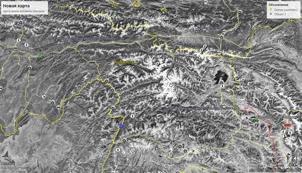
Karst plateau on the Vakhsh ridge
Southern Tajikistan is very different from the Pamir mountain system in its climatic and geological conditions. The absolute elevations here are much lower than in the Pamir.
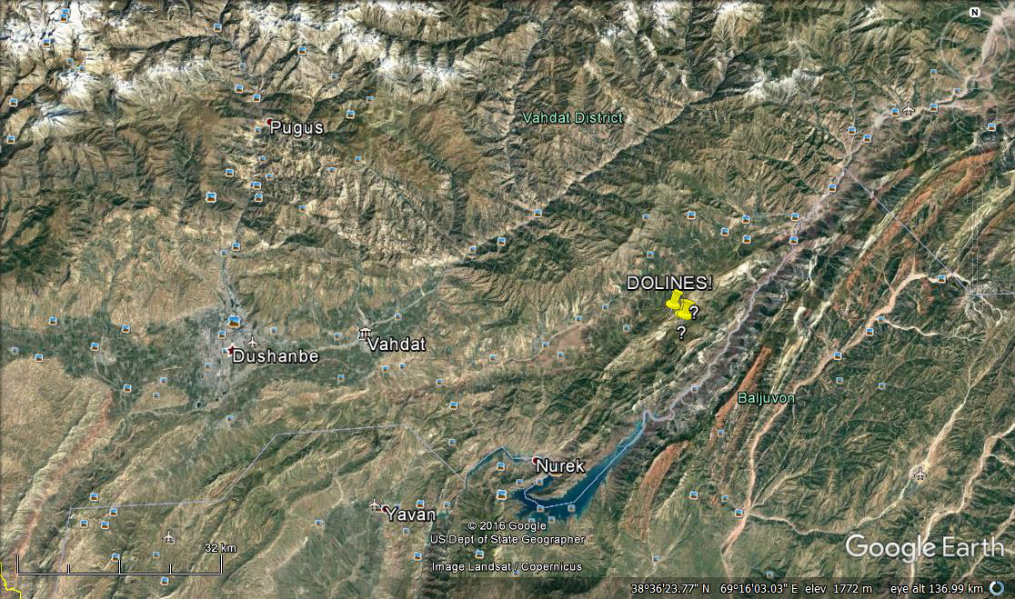
Our Tajik colleagues provided information about an interesting and promising karst plateau, which is located in the north of the Vakhsh River. The nearest town is Nurek. Nurek is the energy capital of Tajikistan, where the Nurek hydropower plant was built.
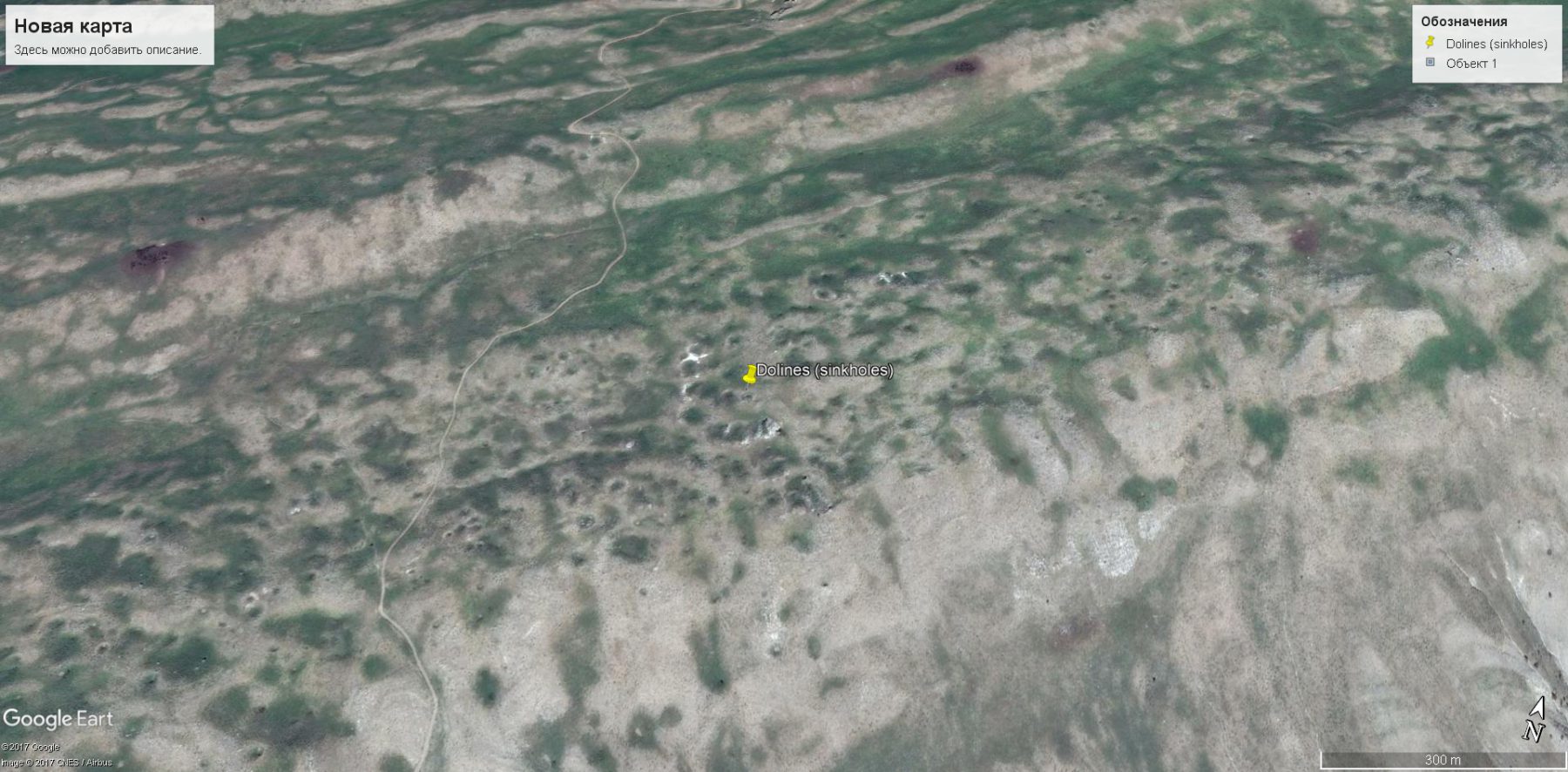
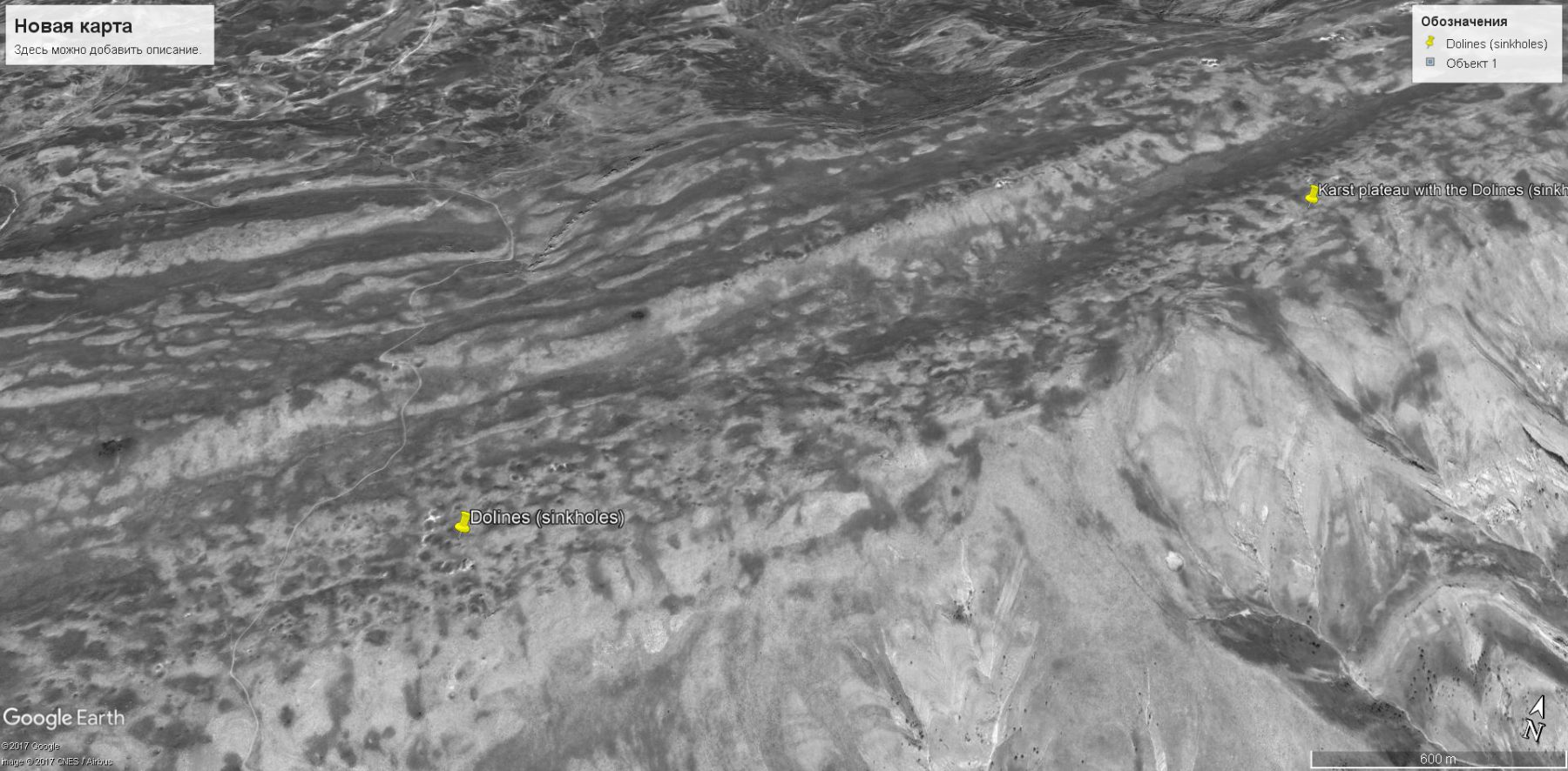
The karst plateau extends from the northeast to the southwest. The total length of the plateau, is more than 30 km, a width of about 1 km. The excess over the base of the slopes is of 300-400 meters. On the plateau were found numerous sinkholes (see satellite image). The diameter of the sinkholes reaches 20-23 meters.
This karst area has never been mentioned before. According to the Tajik geologists, these plateaus and sinkholes formed in the limestone layers of Cretaceous age. In addition, there are layers of gypsum rock.
This amount of sinkholes indicates quite a common karst system. Some sinkholes are aligned relative to each other, which suggests their affinity to the tectonic faults or the contact between layers of rocks. The climate in the area of the planned expedition is quite warm. The air temperature in summer in the valley reaches 40 degrees. In the area of the karst plateau, the temperature reaches 30 degrees. The average annual precipitation ranges from 450 to 550 mm. The main water basin is the Vakhsh river valley, which is located to the south, parallel to the long plateau. The karst area, is relatively easily accessible and is located 100 kilometers from Dushanbe.
Objectives and goals:
1. Evaluation of the prospects of the karst area.
2. Inspection of karst sinkholes.
3. Search and research of caves.
4. Topographic mapping.
5. Hydrogeological research.
6. Speleobiological research.
Logistics:
Arrival of the participants of the expedition to the capital of Tajikistan in Dushanbe.
Overnight at the hotel. Discussion of plans, preparation.
Moving from Dushanbe to the base camp by mini bus Mercedes Sprinter (100 km.).
Setting up the base camp at the base of the northwestern slope of the mountain range.
For transportation in the area of the expedition will be used an off-road vehicle.
During the expedition, we plan to explore the alternative karst areas of South Tajikistan. For this we will use cars provided by our colleagues from Tajikistan.
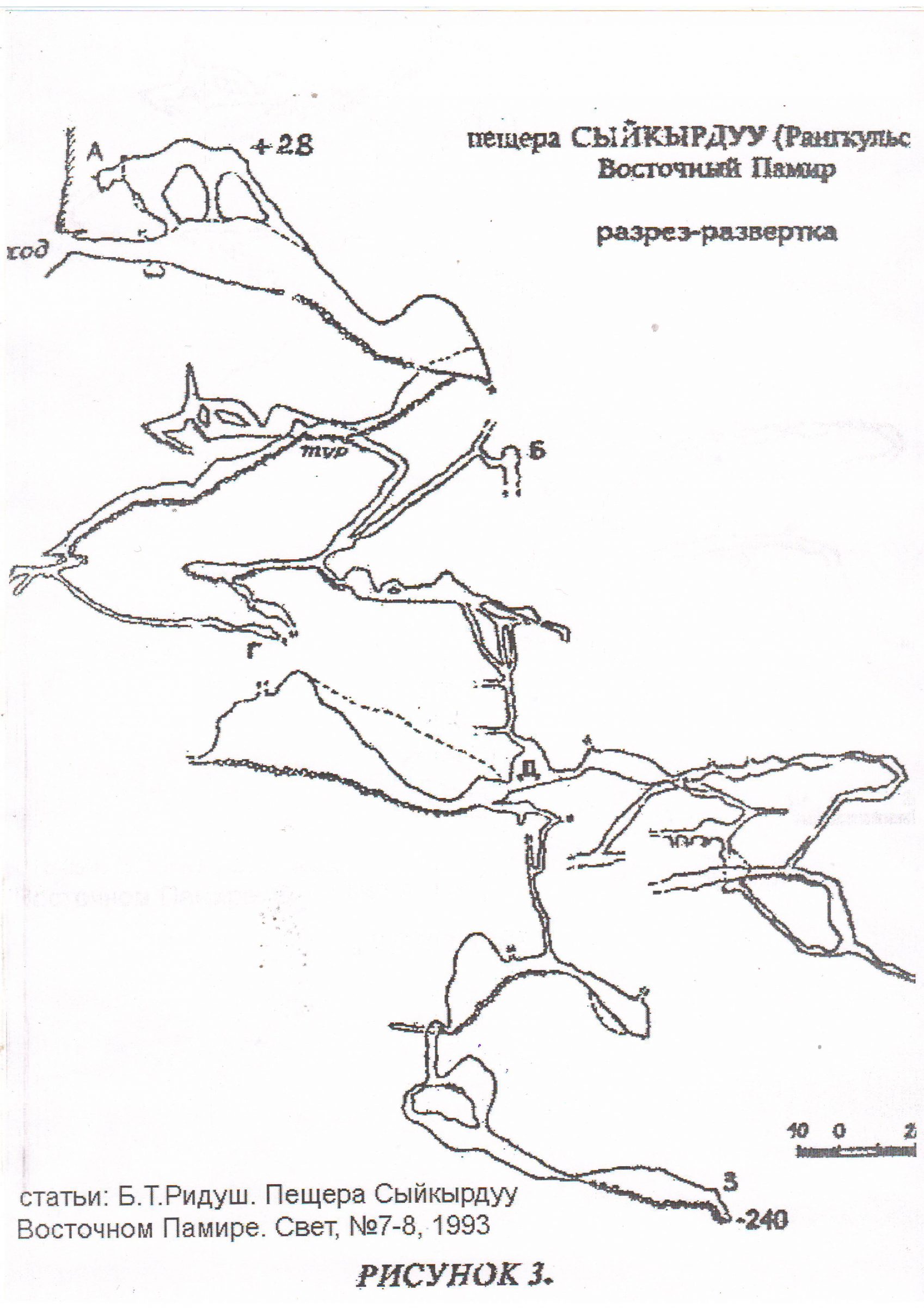
Cave Rangkulskaya (Sykykirduu-Unkur). Continuation of research.
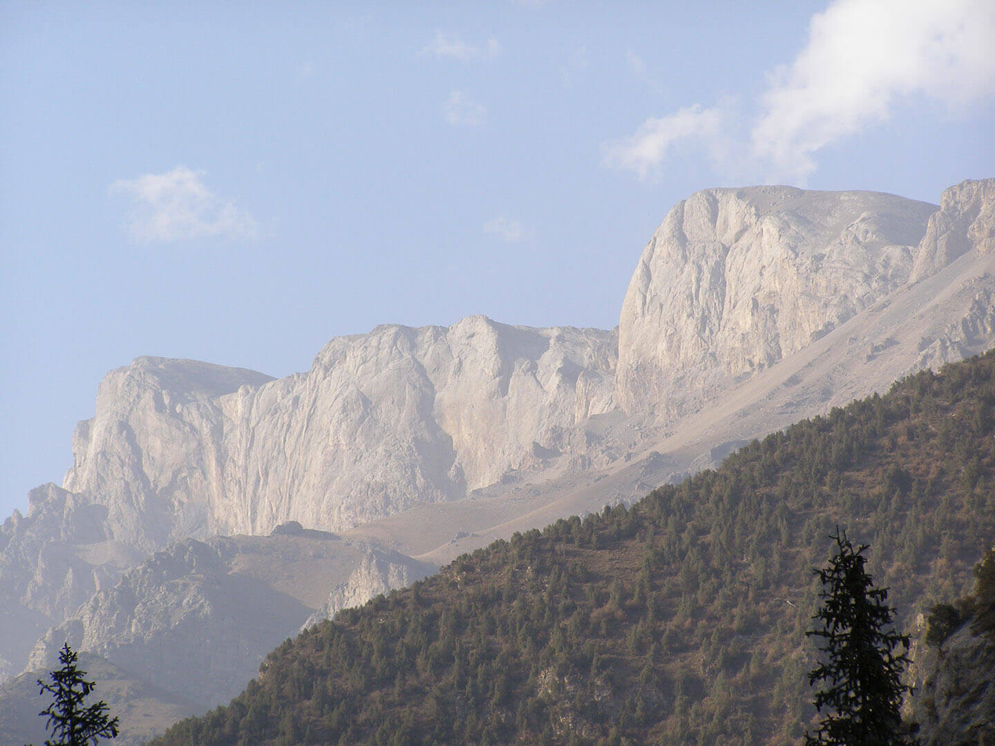
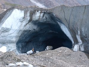
The entrance to the cave is located at an absolute altitude of about 4400 meters on the southern slope in the thickness of the limestone mountain range Chyrak-Tash. The entrance is on a steep limestone cliff, at an altitude of about 250 meters from the bottom of the vertical wall.
Despite the long history of the exploration of the cave, its description, topographic survey and prospects for its continuation remained very incomprehensible. The expedition of the Ukrainian speleologists in 1992 set itself the task to find out the main characteristics of the cave. The cave has a complex 3-dimensional structure and is part of an ancient hydrothermocarstic system formed in the Triassic limestones and subsequently exposed by glacial erosion.
The length of the investigated part of the cave is 2050 m, the amplitude is 268 m (-240; +28). According to geological features, and with further research, the amplitude of the system can be 600-700 m.
The cave is located in the limestone massif of Charok-Tash, which is located to the south of Lake Rangkul. The relative excess of the entrance over the adjacent valley is 600 m.
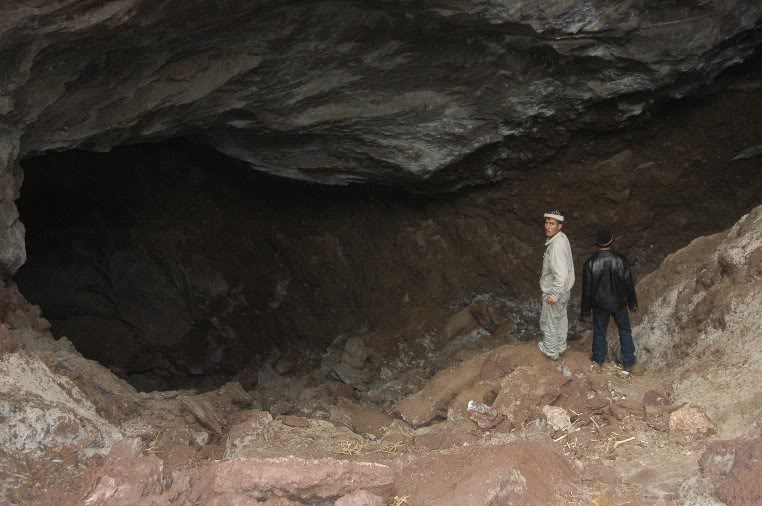
Above the entrance to the cave there is a sheer rock wall about 100 m high, which goes higher into a steep slope that ends with a rocky ridge with a peak of 4774 m. The entry hole is irregular in shape (about 3.5 m in height and 5.0 m in width). The entrance is formed along an inclined tectonic fissure, which cuts the whole limestone massif and is traced in a steep wall. The exposition of the entrance is southern.
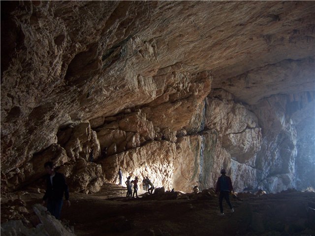
The cave begins with a large hall, steeply descending in a northeasterly direction. Its height reaches 25-30 m, and the width is 15-25 m. There are several fireplaces in the ceiling of the entrance hall (vertical stone pipes leaving to the top), which are taken out to the upper gallery above the hall. Several of the continuations of this gallery, both up and down, are blocked by cork of ancient ice. Some of the fireplaces were left undetected and presumably lead to the upper tiers of the cave. One of the signs of the existence of these tiers is the presence of a number of cave holes in the rock wall above the main entrance, which are framed by a crystalline crust.
Just behind the entrance is a large hall. Hence the network of horizontal and inclined corridors diverges in different directions, which then turn into relatively narrow (1.0-1.5 m) vertical or steeply-pitched wells. Some of the wells lead to the underlying subhorizontal tier, consisting of a number of galleries and halls.

Further inland, the cave consists of a number of relatively small galleries and halls located at different levels and connected by a network of fractured (along the cracks of bedding) and cylindrical wells. The maximum depth of the cave was reached at the southeastern point of the cave system and amounted to -240 m. Together with the upper floor of the cave (+28 m), the total amplitude of the investigated cave part is 268 m.
The total length of the cave passages plotted on the map, according to the materials of the expeditions of Russian and Ukrainian speleologists, was 2050 m.
The limestone layers are inclined in the southeastern direction (azimuth 110-125 °), with an angle of incidence of 45-65 °. In the same direction, the development of the cave system, which is a three-dimensional labyrinth inclined sub-parallel to the fall of the limestone stratum, is observed. In the cave formed 7-8 tiers of horizontal cavities of the cave.
On the opposite slope of the ridge, in the Kalak-Tash gorge, in the rock wall there are several cave entrances, laid also on the fall of the mountain layers. This indicates the relationship of these inputs to the common cave system. If this hypothesis is confirmed, the prospective depth of the system can reach 500-600 m. Upward, inside the mountain massif, it is also possible to continue the cave to a height of about 100 m. Thus, in the future, the amplitude of the development of the cave system can be 600-700 m. so that the length of the uncovered part of the cave may exceed a certain length, by 2-3 times.
There are no modern watercourses in the cave. Condensation waters are also not formed, since the air temperatures in the cave are either negative or close to zero, and the air humidity in the Eastern Pamirs is extremely low.
An interesting fact is finding a cave of fossil ice. Ice formations are relict fragments of a larger underground glacier that existed in the past. The age of the cave glacier can be attributed to the time of the existence of extensive glaciation in the Eastern Pamirs.
There were no discharges of karst water in the vicinity of the massif. But, there are data from some local researchers (Muratov R.Sh.) that at the bottom of Lake Rangkul unloading of high-yield sources with sufficiently high, apparently carbonate, mineralization occurs.
Inside the cave, in some areas there is a fairly strong flow of air, which can be observed by a strong deviation of the candle flame. Following the direction of the air flow ("by pull") inside the cave, the last expedition found that it does not originate from the deepest, southeastern part of the system, but from the northeast. Here, the passage of the cave stopped in front of several narrow wells, clogged with caving blocks. Ascending streams of air come out through blocky debris in the wells.
The gas composition of air was not determined. However, there is an oral message from speleologists from the city of Balashikha that during one of the expeditions in the cave there was a smell of hydrogen sulfide.
The walls of the cave and the ceiling are almost universally covered with a layer of milky white coarse-grained calcite, from several millimeters to several centimeters. In many places, the calcite layer evenly covers also collapsed blocks.
At a depth of about 130 m there are corallites. Some cave formations, possibly associated with condensation waters, which were formed during short periods of warming and humidifying the climate on the surface.
А characteristic feature of the cave is the wide distribution in it of silty sediments, the so-called "cave-forests". These deposits have aeolian origin and are especially actively accumulated in those parts of the cave where air flows are as weak as possible. In such places, a layer of non-caked dust reaches 5-10 cm.
The question of habitation of bats remains open. But, the biogenic deposits are represented by the litter of bats.
Mention of bats is only in one of the legends, which says that when several Kyrgyz tried to penetrate deep into the cave, they found themselves in a "long narrow corridor, in which there were many huge bats, often blowing out candles." Thus, the time and nature of the habitat Bats in this cave remain a mystery.
Among the locals, the cave is known for a long time and is surrounded by various legends. The first mention of the cave in literature refers to 1898. It also cites one of the legends that tells of the death of a Chinese detachment during a forced wintering in a cave.

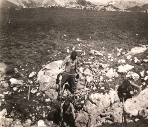
In 1988 the expedition of the Moscow speleologists reached a depth of 240 m. Topographic survey was conducted.
In 1992 an expedition of the Ukrainian Speleological Association was held. During the expedition, an underground ascension was made, as a result of which an upper gallery was found in the entrance hall with deposits of ancient ice. At the same time, topographic surveying of new parts of the cave was carried out, as a result, 0.5 km was added to the total length of the cave. Work was carried out to find promising extensions and disassembly of debris.
As a result, it should be noted that the cave Rangkulskaya (Sykykirduu-Unkur) is unique for the Pamir speleological object. It is part of an ancient hydrothermocarst system, which was opened by glacial erosion. Due to the successful location of the entrance, it was not buried beneath moraine deposits, nor under a deluvial plume. At the same time, due to the dry climate in the Eastern Pamirs in the Holocene, later karst processes did not develop further, and the cave was preserved in a relatively primitive form, completely preserving the signs of hydrothermocarst development (Dublyansky, 1990).
Despite the vigorous research activities of several expeditions, the cave still remains insufficiently studied and is of great interest, both from the speleological and archaeological point of view.
The climate in this area is severe. There is a sharp temperature fluctuation during the night and daytime. The average annual precipitation is about 100 mm.
Logistics
Goals and objectives:
1. Estimation of the karst area
2. Research of the cave Rangkulskaya (Sykykirduu-Unkur)
3. Topographic shooting in 3D.
4. Analysis of debris inside the cave with the aim of opening new galleries and continuing the cave
5. Investigation of entrances located on high rock cliffs in a given area.
6. Search and exploration of new caves in the expedition area.
7. Geological investigations
8. Hydrogeological investigations
9. Speleological research
10. Speleo-archeological research.