1
About the Tacta-Boz project:
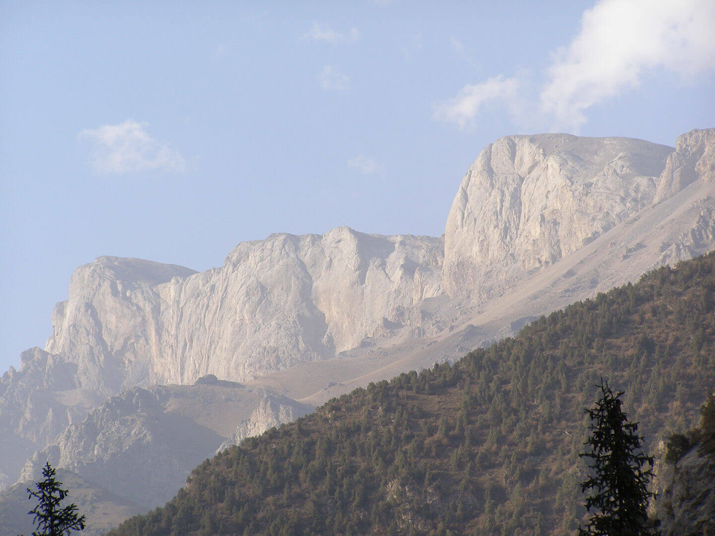
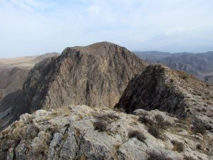
The Tacta-Boz mountain range is composed entirely of carboniferous (C) and devonian (D) limestone. This limestone represents is a single array with a many tectonic faults. The length of the mountain range is more than 50 km.
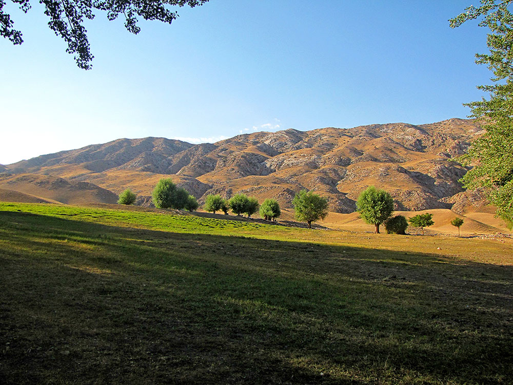
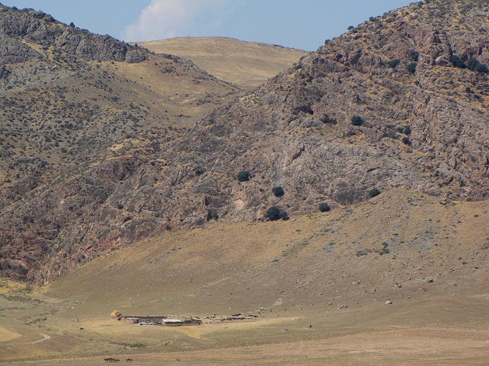
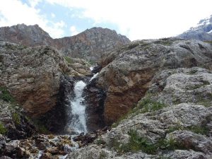
The ridge is located between the Fergana Valley and the Turkestan mountain range. Geologically, it belongs to the tectonic system of the Southern Tien Shan. The mountain range is located in a sharply continental climate with hot summers and cold winters. Despite the fact that the ridge is surrounded by a desert landscape, it is a large accumulator of humidity in the autumn, winter and spring. Karst springs, which are drained at the foot of the mountain range, form saving oases in the summer heat. These springs have almost constant discharge in winter and summer. The discharge of springs reaches 30-40 liters per second.
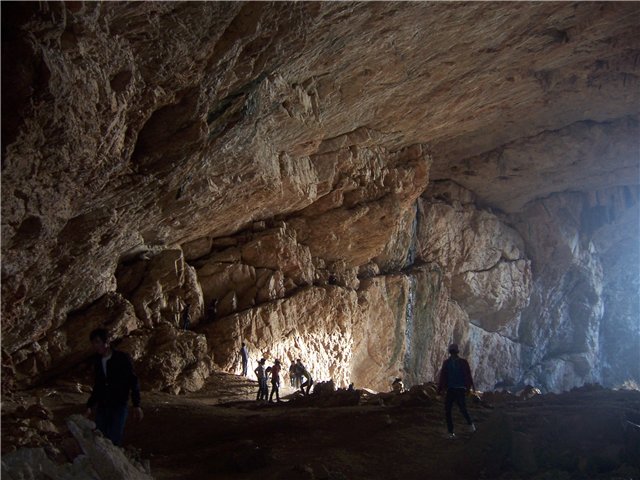
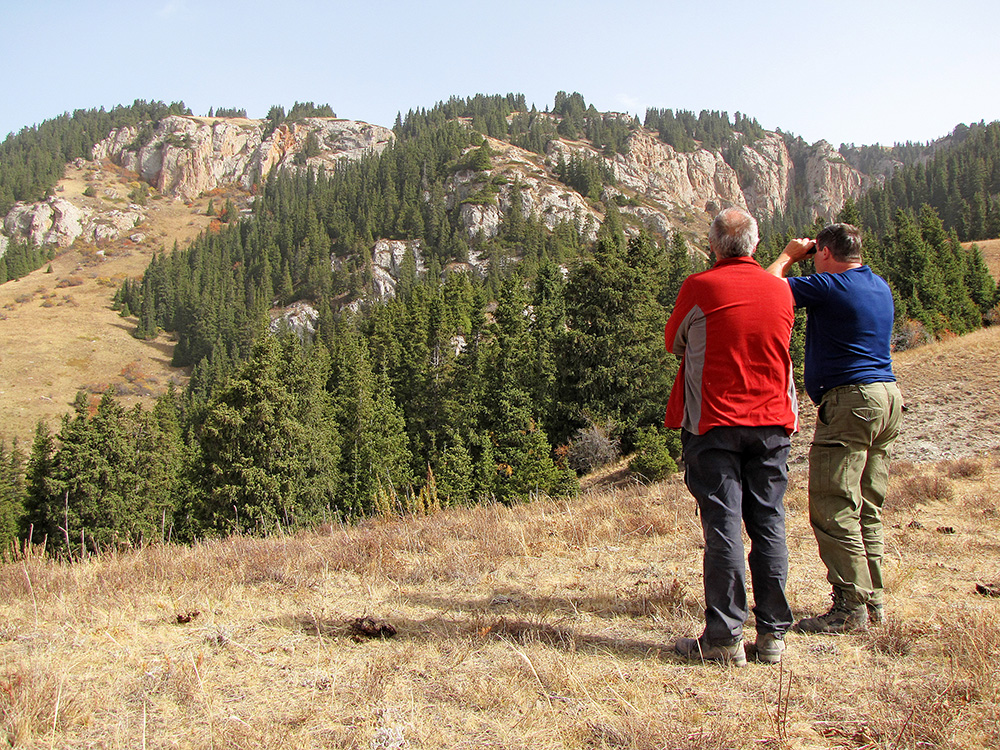
The classic karst landscape can be seen on the northern slopes of the mountain range. Here you can see a lot of perspective dark openings, both on the vertical non-accessable walls of canyons, and in easily accessible canyons.
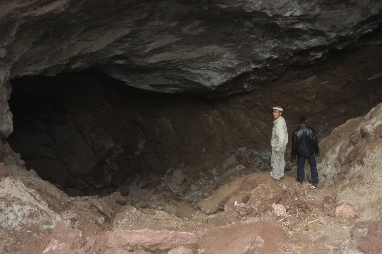
During the expedition in 2017, locals told speleologists about very narrow entrances, followed by large underground galleries and halls. Due to lack of time, we could not make any research of these entrances, leaving them for future expeditions. In the gorges and on the plateau of the massif there are many signs of hypogenic karst in the form of grottoes, niches, arches and other forms. Speleologists explored only a small karst area in the Madygen oasis.
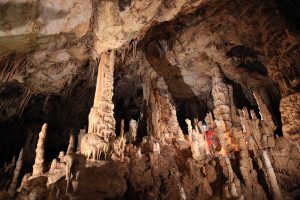
An important geological feature is also the fact that the Takta-Boz range is located along the zone of influence of the South Fergana hydrothermal mineral belt. Therefore, caves of hydrothermal karst should form in its limestone strata. The hydrothermal zone has some of the most beautiful caves of Kyrgyzstan.
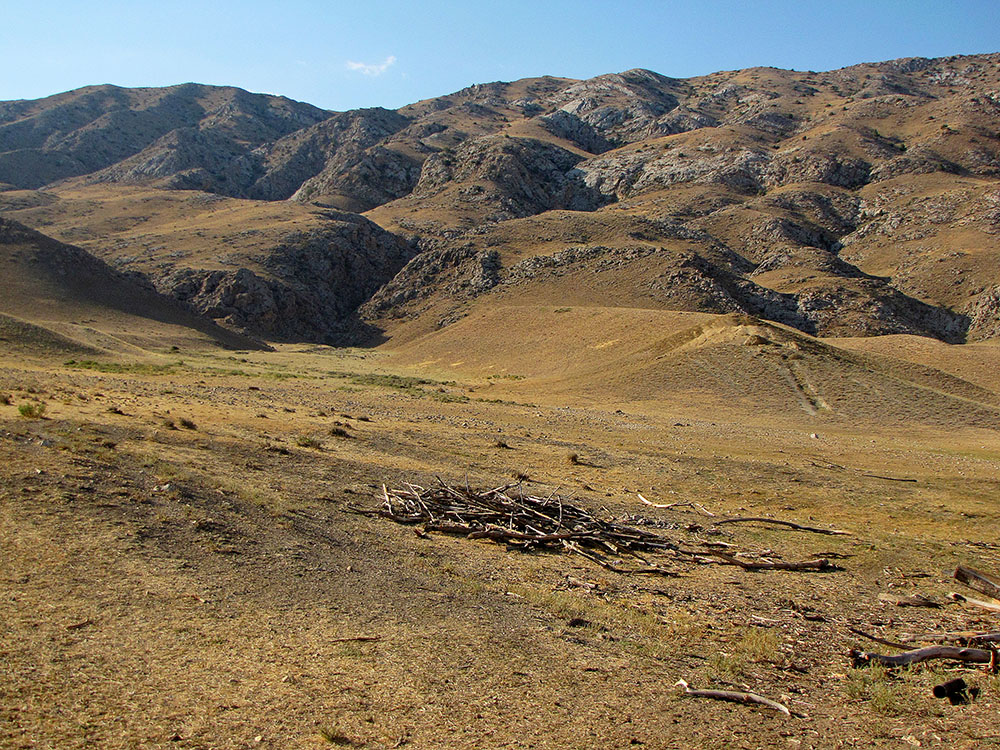
The karst region occupies the area of the low-mountain and middle-mountain climatic belts. The southern and northern slopes of the ridge represent a classic karst landscape. In 1975, geologists discovered several karst sinkholes (dolines) in the eastern part of the limestone ridge. The diameter of the karst sinkholes is about 20-30 m, and the depth is up to 1-2 m. Some of the sinkholes (dolines) end as narrow caves in which the water of precipitation disappears in the spring.
To date, the karst area has not been studied. For the first time, 3 caves were found here in 1975. Locals can show several entrances, from where, according to them, there is a flow of warm air.
On the vertical canyon walls there are several attractive black openings confined to tectonic faults. For their research it is necessary to have special training and equipment. Some easily accessible entrances have a small diameter, which require special methods and tools for their expansion.
Climatic conditions here are very contrasting. In summer, the average daily air temperature is 30-35 degrees. Winter is warm with air temperatures of 10-15 degrees.
One of the perspective entrances is located on the right vertical wall of the canyon Madygen. Entrance height is about 10 m, width is about 5 m.
Madygen Canyons:
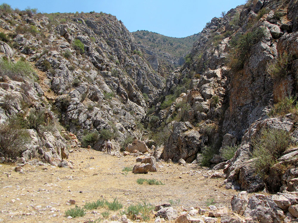
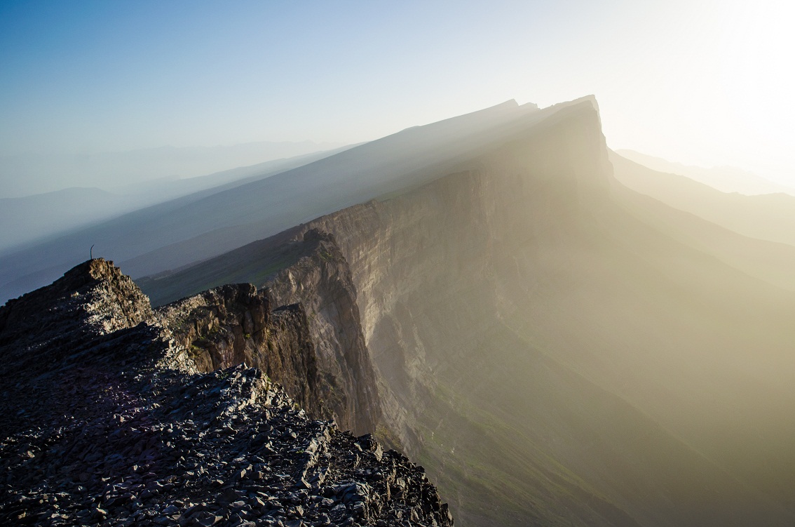
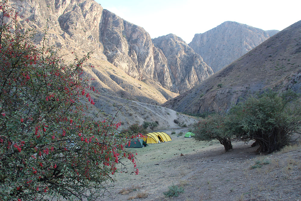
For the first time, these canyons were discovered by speleologists in 2017. They were formed in the limestones of the carboniferous age (C) along tectonic faults. The vertical walls of the canyons reach heights of about 300-400 m. In some places, the width of the canyons barely reaches 1 m. Therefore, the narrowness of the canyons does not allow to visually seeing the entrances to the caves on the high vertical walls of the canyons.
A stream flows through the channel of the main canyon all year round, the source of which are karst springs draining the northern slopes of the Tact-Boz massif. In summer, the channel of the canyon is filled with water, which makes excellent conditions for canyoning. In order to pass the canyon along its entire length, you will need several pieces of rope, from 5 to 20 m. Therefore, several vertical ledges and flooded areas make the canyon impassable, especially in spring.
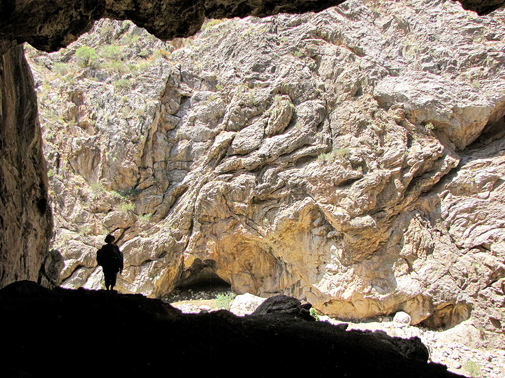
In 2017, during a reconnaissance expedition, on the western vertical wall of the canyon, a huge promising entrance was discovered, which was called “Soaring”. The entrance is confined to a vertical fracture that cuts through the entire strata of limestone, from the plateau to the foot of the vertical walls of the canyon. The thickness of the limestone strata above the entrance is about 150 m. The height of the wall between the entrance and the bottom of the canyon is about 150-200 m. Therefore, to get to this entrance special equipment and a team of professionals will be needed. In our opinion, behind this promising entrance there should be a rather large cave system.
In the summer months, the air temperature reaches 35-40 degrees. In places of drainage of karst sources, there are small oases, which are the only sources of water in the surrounding rocky desert.
In addition, we plan to explore the western karst areas of the ridge, limited by the valley of the river Leilek, where, according to the descriptions of geologists, there are several caves.
Our Foundation has received all necessary permits from the State Agency for Environmental Protection, as well as the support of local authorities to conduct research expeditions. In this regard, speleological researches are planned in 2019-2020.
All interested speleologists can take part in the research. The best option in terms of logistics and cost would be for the team to be at least 8-10 people. The optimal period of the expedition for searching and researching new caves is two weeks.
Objectives and goals:
Expedition dates can be changed. If the group is one – from one club, association, federation, then the group has the right to change the dates of the expedition. If the group is mixed, then we rely on our capabilities and the capabilities of the majority of potential participants. At the moment we have indicated the most favorable season of the year according to the climatic conditions in a particular geographical area. The best time for the expedition is the first half of August.
Expedition program (preliminary)
Day 1. Arrival in Bishkek. Hotel accommodation. Briefing
Day 2. Arrival in the city of Osh. Stay in a guest house.
Day 3. Arrive at base camp. Setting the base camp.
Day 4-8. Exploration of the Takta-Boz area
Day 9-11. Exploration of the Beli-Synyk area
Day 12-13. Return to Bishkek
Day 14. Departure home
If necessary, we will be able to rent horses. But, it is better to use our cars for radial trips around Takta-Boz mountain. To work effectively, it is necessary to make radial exits to the plateau and canyons.