1
The program of the Karst expedition and the caves of Tajikistan.The described program is flexible. We can change the length of our stay in a particular area.
The purpose of the expedition:
– Speleological research
– Exploration of karst areas
– Search and study of caves
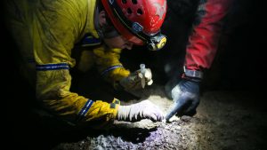
– Biological research
– Geological research
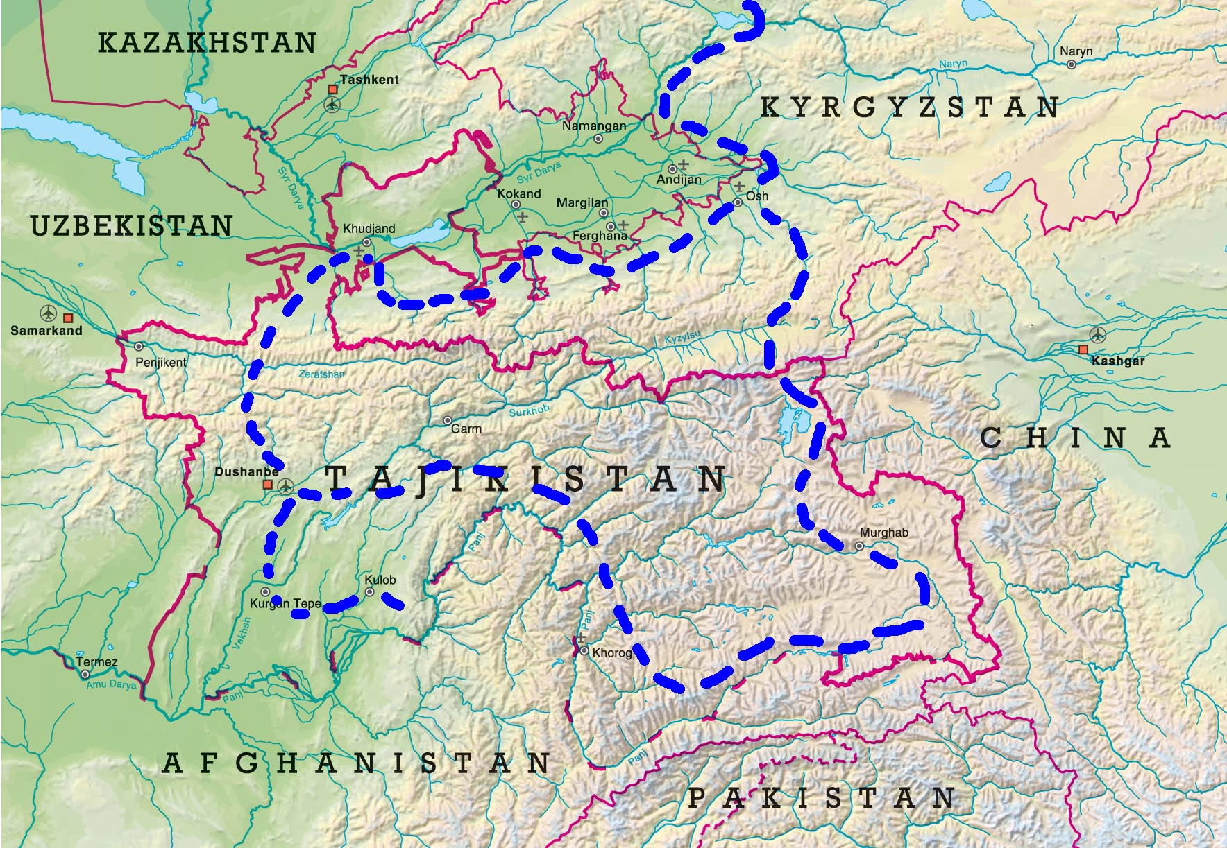
Day 1. July 06. The expedition begins in the Osh City. Those interested can come to Osh. The Osh city also has an international airport, where flights from Bishkek arrive. Members of the expedition, who will visit Kyrgyzstan for the first time and arrive in Bishkek, can join us and enjoy the trip from Bishkek to Osh (630 km).
Day 2. July 07. In the morning, our expedition will continue to the west in the direction of the Batken City and on to Khujand, the northern capital of Tajikistan. Field camp near the Kairakum reservoir.
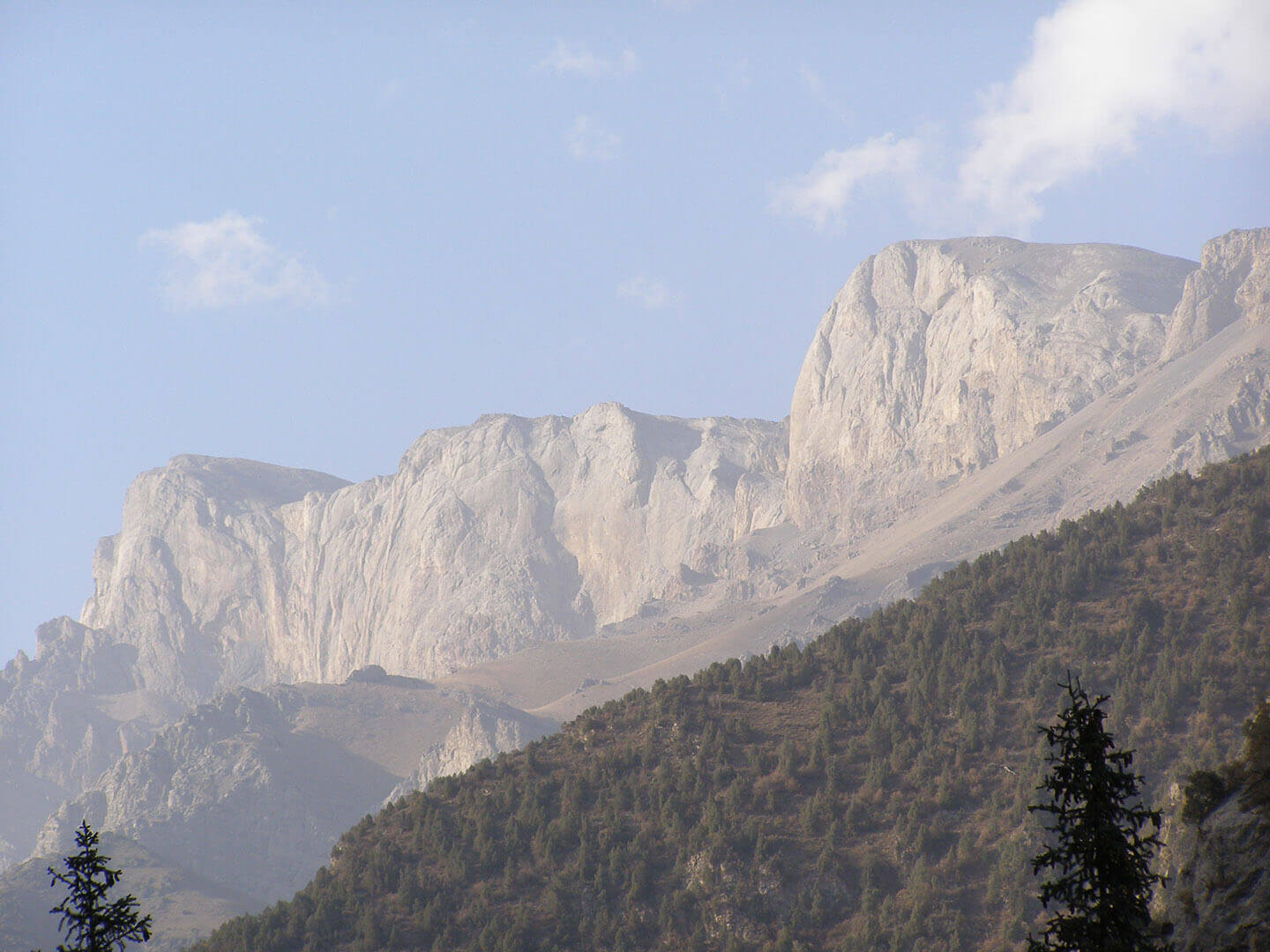
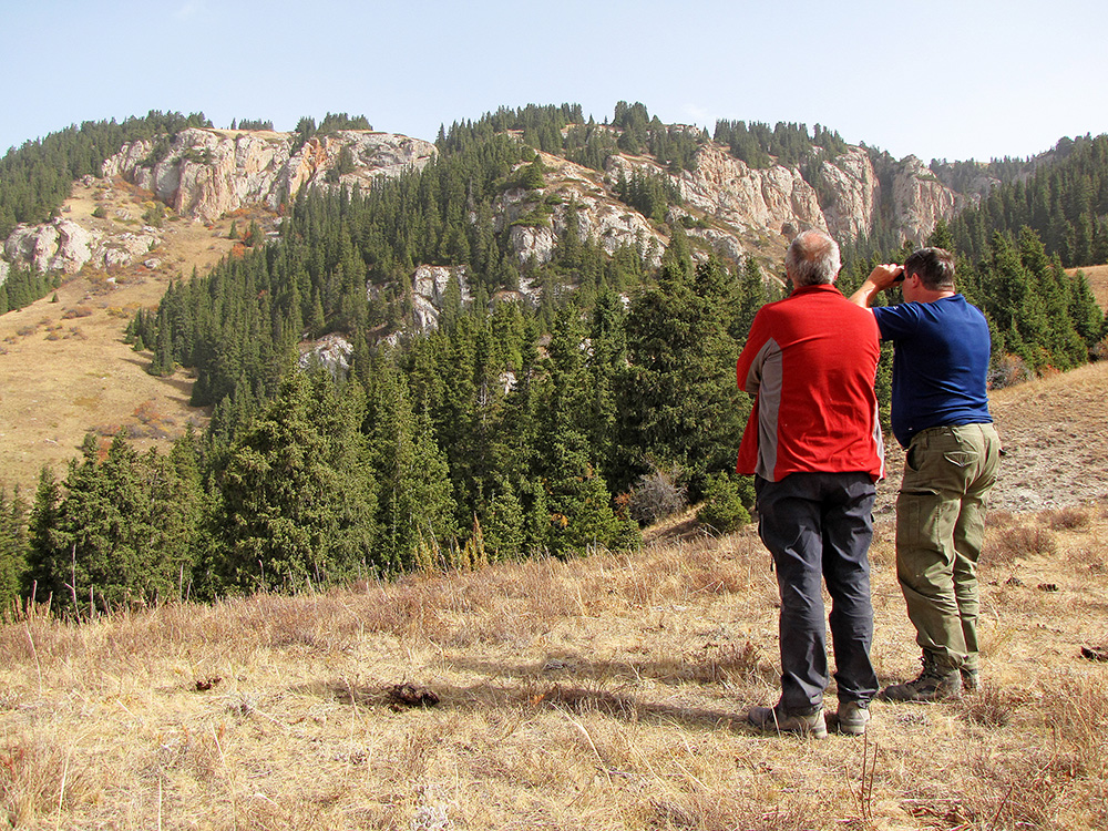
Days 3. July 08. Study of the southern slopes of the Kuramin ridge. The main source of the Kairakum reservoir is the large river of Central Asia – Syrdarya. Here are located sources of hydrogen sulfide – Aksukon. The desert landscape is formed by Mesozoic salt layers. But we are interested in the Kuramin Range, composed of Paleozoic limestone rocks.
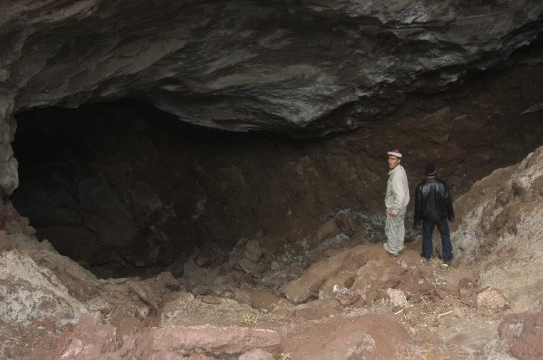
This area is known as Kara-Mazar. These are ancient cave mines – IV-XX centuries. Where ancient miners mined polymetallic ores. As a result, over 1500 years, mixed artificial-natural underground cavities were formed. Until now, people do not know the true size, length and depth of these underground labyrinths and huge underground halls. In the caves live bats and other fauna.
But, besides the ancient cave mines in the gorges of this mountain range, there may be caves that we want to find or understand the prospect of further exploration. Although the cave mines also never explored.
Day 4. July 09. We travel to the south of Tajikistan. From Khujand, our journey continues to Ura-Tyube and further, through the Turkestan and Gissar ranges, we descend in the direction of the Tajik depression to the capital of Tajikistan – Dushanbe. On the way, on the same day, we plan to stop in the area of Shirkent National Park.
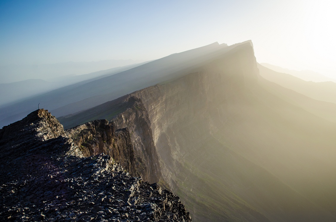
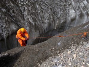
The Vakhsh Range is like a limestone and gypsum layer cake. On the plateau of the ridge, at an altitude of 2700 m, numerous sinkholes can be seen. Sinkholes are limited to tectonic disturbances. The diameter of some of them reaches 30-35 m.
Days 8. July 13. The study of sinkholes. The length of the mountain range is about 20 km, the plateau width is up to 1 km.
Day 9. July 14. Transfer to Kulyab. Here are one of the world’s largest mountain ranges, which are completely composed of rock salt. Night in the field camp.
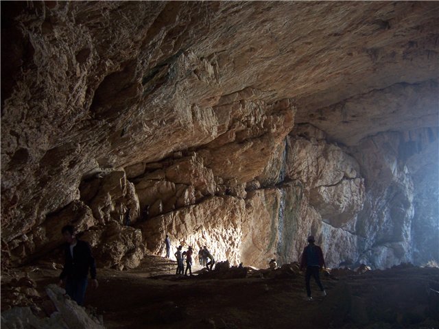
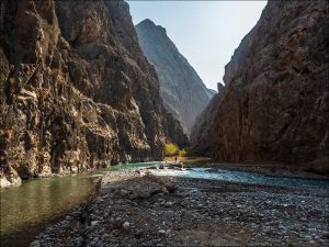
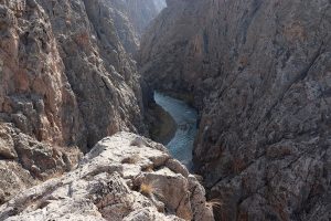
Days 10-11. July 15-16. In the salt strata formed several large caves. We want to explore these caves and magnificent salt canyons. These studies will be useful for biologists and geologists.

Conditions of the expedition:
– If you decide to go to the Pamirs, then you must issue an electronic pass to Gorniy Badakhshan on the Internet website: www.evisa.tj
– The cost of participation in the expedition depend from quantuty the participants
The price includes:
Description
If you are not sure whether to go or not to go to Tajikistan, you need to read this short note.
20 years ago, the country experienced tension and political instability as a result of the consequences of the civil war. Europeans and neighboring nations were afraid to go to central Tajikistan and to its eastern highland, the Pamir. But now the situation has changed. Tajikistan is a fast developing country. In the last 5 years, the country has been actively developing tourism, economy, science and education. More and more foreigners are arriving to the country to get to know it better. I personally have been to Tajikistan several times. There are several ethnic groups who speak different dialects. Different peoples can live in different canyons and not know about the existence of each other. The people of Tajikistan are very hospitable and progressive.
Today’s peaceful stability in the country is ensured by the stay of the Russian army here. The cooperation of the Tajik and Russian military ensures a peaceful development of the country, which makes it possible to promote various researches and projects here.
Therefore, our transboundary speleological project to study unknown karst areas and caves in Tajikistan is the first official project which will be implemented with the support of local Tajik geologists who know the natural conditions of the country.
In this regard, we want to learn more about the natural conditions of the country, get acquainted with one of the most ancient cultures in Central Asia, discover new caves and understand the prospects for further research.
Future expeditions have several tasks: speleological, biological and other studies related to caves and karst.
In the Pamir, we plan to explore the highest cave in the world, the entrance to which is located at an altitude of more than 4,400 meters above sea level. This project can only be carried out by a good team of researchers. As the high altitude of the area, the high mountain desert and the harsh climate, require acclimatization and good physical preparation of the team members.
But this year we decided to limit ourselves to the reconnaissance of several karst areas. Therefore, the northern and western karst regions of the Kuramin and Gissar ridges are of the greatest interest. In the Kuramin ridge, in their reports, Soviet geologists described various caves and ancient many-kilometer-long cave mines. To date, the length and volume of these caves is unknown. In the Zeravshan ridge, some geographers and geologists also described caves and grottoes. But all information should be checked by speleologists.
In the south of Tajikistan, the unique salt karst and caves in the Khoja Mumin mountain range are of great interest. This mountain range is completely composed of tectonic salt. In 1989, for 5 days a group of Kyrgyz speleologists explored only a small part of the mountain range. They discovered 2 large caves, 2 700 m and 550 m. There is an amazing combination of a dry climate and a large number of springs which drain around the whole mountain range. It is not clear where the water is coming from.
We hope that our idea will attract interested researchers, and we will carry out an official expedition to explore karst areas and caves in Tajikistan in 2019.